Low pressure area may form in Bay of Bengal by Nov 9, could move towards TN coast on Nov 10, 11
The Hindu
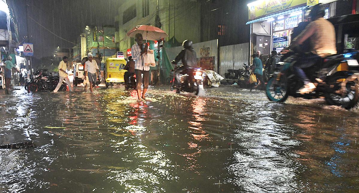
Isolated thunderstorms with lightning are also very likely to continue till November 6, the Regional Meteorological Centre, Chennai, has said
The Regional Meteorological Centre (RMC) in Chennai, announced on Friday that a low pressure area was likely to form over southwest Bay of Bengal, off the coast of Sri Lanka, around November 9.
Additional Director-General of Meteorology, S. Balachandran, told presspersons that the system was likely to move northwestwards towards the Tamil Nadu and Puducherry coasts on November 10 and 11. Fishermen have been advised not to venture to the south and central Bay from November 9.
The upper air circulation that was over Tamil Nadu now lay over the Kerala coast and its neighbourhood, and the east-west sheer zone, where the easterlies and westerly winds meet, was running from this system to the South Andaman Sea, bringing fairly widespread light to moderate rainfall over Tamil Nadu, Puducherry and Karaikal, he said.
Isolated thunderstorms with lightning were also very likely to continue till November 6.
Mr. Balachandran said that in the last 24 hours ending 8.30 a.m. Friday, Tondiarpet in Chennai recorded 14 cm of rain, followed by the DGP Office on Kamaraj Salai, Chennai, and Mettupalayam in Coimbatore district with 12 cm. Vedaranyam and Kayalpattinam recorded 10 cm each, while Perambur in Chennai registered 9 cm.
The rain gauges at Kayathar, Srivaikuntam and Kadambur in Thoothukudi and at the Chennai district collectorate recorded 8 cm of rain each. The stations at Ayanavaram, Anna University, the Chennai meteorological office at Nungambakkam and Ambattur and Red Hills recorded 7 cm each.

Parents of deceased Badlapur sexual assault accused withdraw case against Thane police in alleged encounter, citing difficulties in pursuing justice.

Deocha Pachami Coal Mining project in West Bengal begins with basalt mining, promising jobs and fair compensation for locals.

Akhilesh Yadav accuses BJP of rigging Milkipur byelection, declares Election Commission "dead" for failing to prevent malpractice.

AAP alleges BJP offered ₹15 crore to 7 candidates to defect after Delhi election; BJP denies, calls it baseless.

Protestors clash with police in Kolkata over SSC recruitment scam, demanding segregation of worthy and unworthy candidates.

Tragic accident involving ITI students at BHEL in Ranipet, Vellore; two run over by lorry, one injured, driver arrested.

R.S. Venkatraman, the voice of Independence for Tamil listeners, passes away at 102 in Chennai.

Nobel Laureate Aaron Ciechanover emphasizes the importance of democracy in science for progress and innovation.

Former Minister and three others convicted in bank fraud case, sentenced to 3 years; released on interim bail.

DMK President M.K. Stalin vows to retain power in 2026, emphasizing party's history of working for people's welfare.

India's EV charging market poised for growth with significant investment, but urgent expansion needed to meet ambitious targets by 2030.

Delhi court summons ED director over failure to provide documents in ₹88-crore SEBI fraud case, accused unable to defend.

Saamana editorial criticizes PM Modi's response to Trump's outsourcing remarks, warns of economic impact on Indian citizens abroad.