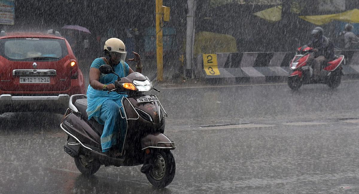
Heavy rainfall forecast over isolated places in Tamil Nadu on November 10
The Hindu
With the system intensifying, more rains are expected for most places in the State on Friday and Saturday
A low pressure area has formed over the Southwest Bay of Bengal and adjoining Equatorial Indian Ocean. This system is likely to bring light to moderate rainfall over many places in Tamil Nadu and Puducherry on Thursday with heavy rains in a few places over Tiruvallur, Chennai, Kancheepuram, Chengalpattu, Villupuram, Cuddalore, Mayiladuthurai, Nagapattinam, Tiruvarur, Thanjavur, Pudukkottai, Sivaganga, Ramanathapuram and Thoothukudi districts, Puducherry and Karaikal.
Announcing this at a press conference, Additional Director General of Meteorology, Regional Meteorological Centre, Chennai, S. Balachandran said that this system was formed under the influence of the cyclonic circulation over Southwest Bay of Bengal and adjoining Equatorial Indian Ocean.
It is likely to become more marked during next 48 hours and is very likely to move northwestwards towards Tamil Nadu and Puducherry coasts during the next 72 hours, he said.
With the system intensifying, more rains are expected for most places in the State on Friday and Saturday. Isolated places are likely to get heavy to very heavy rainfall in these two days.
For Friday, light to moderate rain has been forecast at most places with isolated thunderstorm and lightning likely to occur over Tamil Nadu, Puducherry and Karaikal area.
Scattered heavy to isolated very heavy rain is likely to occur over Tirupattur, Vellore, Ranipet, Tiruvallur, Chennai, Kancheepuram, Chengalpattu, Villupuram, Cuddalore, Mayiladuthurai, Nagapattinam, Tiruvarur, Thanjavur, Pudukkottai, Sivaganga, Ramanathapuram and Virudhunagar, Puducherry and Karaikal.
Heavy rain is likely to occur at a few places over Tiruvannamalai, Kallakurichi, Perambalur, Ariyalur, Tiruchirappalli, Karur, Dindigul, Theni, Madurai, Tenkasi, Thoothukudi, Tirunelveli and Kanniyakumari districts.

Over 4.27 lakh students begin SSLC and Plus Two exams in Kerala, with various subjects and exam centers.

Discussion on major development projects, including drinking water, drainage, and parking systems, at the District Development Coordination and Monitoring Committee meeting.

Water Resources Minister Nimmala Ramanaidu has stated that Godavari Pushkaralu will be conducted from July 23 to August 3, 2027.

Rising obesity rates in India, particularly among women in South Indian States, highlighted with BMI data and PM Modi's advice.

Special educator Soumya Devadiga selected as coach for Indian team in Special Olympics Winter Games in Italy.

Gade Srinivasulu Naidu wins North Coastal Andhra Pradesh Teachers' Constituency election with overwhelming support from teachers.

Congress alleges BJP government in Madhya Pradesh plans to privatise 40% of forests, displacing tribals from their habitat.

Tamil Nadu Governor R.N. Ravi advocates renaming Indus Valley Civilization to Saraswathi Civilization, challenging historical narratives.

A study by researchers from NIMHANS, in collaboration with doctors from Australia, United Kingdom and some states in India, has found suicidal ideation and suicide attempts alarmingly high among college students across the country.

First trial run of disposing 10-tonne Union Carbide toxic waste in Pithampur begins after Supreme Court's decision.

Telangana tunnel collapse rescue updates: Follow the Hindu’s updates as Srisailam Left Bank Canal tunnel rescue operations enter the 11th day

First trial run of disposing 10-tonne Union Carbide toxic waste in Pithampur begins after Supreme Court's decision.

Rwanda-backed M23 rebels abduct 130 patients from hospitals in eastern Congo, escalating conflict and sparking international concern.