Climate change and how hurricane Milton became a Category 5 storm Premium
The Hindu
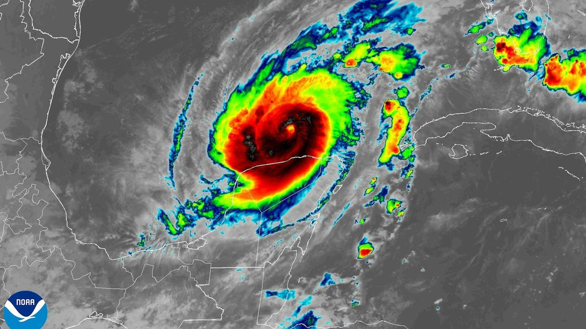
Hurricane Milton rapidly intensified into a Category 5 storm, highlighting the connection between climate change and extreme weather events.
Hurricane Milton became one of the most rapidly intensifying storms on record as it went from barely hurricane strength to a dangerous Category 5 storm in less than a day on a path across the Gulf of Mexico toward Florida.
With sustained winds that reached 180 mph on Oct. 7, 2024, and very low pressure, it also became one of the strongest Atlantic storms.
Milton’s winds dipped to Category 4 strength early on Oct. 8, but forecasters warned that it would still be an extremely dangerous hurricane at landfall.
Less than two weeks after Hurricane Helene’s devastating impact, this kind of storm was the last thing Florida wanted to see. Hurricane Milton was expected to make landfall as a major hurricane on Oct. 9 and had already prompted widespread evacuations.
So, what exactly is rapid intensification, and what does global climate change have to do with it? We research hurricane behaviour and teach meteorology. Here’s what you need to know.
Rapid intensification is defined by the National Weather Service as an increase in a tropical cyclone’s maximum sustained wind speed of at least 30 knots – about 35 mph within a 24-hour period. That increase can be enough to escalate a storm from Category 1 to Category 3 on the Saffir-Simpson scale.
Milton’s wind speed went from 80 mph to 175 mph from 1 p.m. Sunday to 1 p.m. Monday, and its pressure dropped from 988 millibars to 911. Most of that intensification was over just 12 hours.

2024 Medicine Nobel for discovery of microRNA: What have the Nobel laureates achieved by unlocking a secret on how different types of cells develop? How will it help in the field of molecular biology? Why is an understanding of genes important? What happens if gene regulation goes awry?

In a special preview, Sharan Apparao gives Sunday Magazine a peek at her favourite pandals from Durga Puja 2024

Explore Uppukinar Lane for affordable fabric, expert tailoring, and vibrant accessories to create a budget-friendly Deepavali outfit.

The 2024 Nobel Prize in chemistry recognized Demis Hassabis, John Jumper and David Baker for using machine learning to tackle one of biology’s biggest challenges: predicting the 3D shape of proteins and designing them from scratch.

A boulevard of native trees including the banyan, neem, fig, peepul and tamarind will beautify Coimbatore’s cityscape as lakhs of trees will be added as part of the Green Tamil Nadu Mission

Hurricane Milton rapidly intensified into a Category 5 storm, highlighting the connection between climate change and extreme weather events.

Scientists study how industrial waste like slag hardens into sedimentary rocks, adversely affecting the environment but also trapping carbon.

The eye catching wooden cow figureheads displayed for Dasara at the Grameena Angadi in Jayanagar are characteristic of Channapatna work

Nobel Prize in Chemistry: he arrangement of amino acids relative to one another determines which function a particular protein will serve. Which is why, understanding the shapes of proteins is the key to understanding how life works.

Europa Clipper will conduct a detailed study of Europa, looking for potential places where it might host alien life.

Hopfield and Hinton's groundbreaking work in artificial neural networks paved the way for modern AI applications like ChatGPT.