The discrepancy between satellite data of farm fires and air pollution | Explained Premium
The Hindu
Delhi's air quality crisis blamed on farm fires, NASA satellites track stubble burning, CAQM under scrutiny.
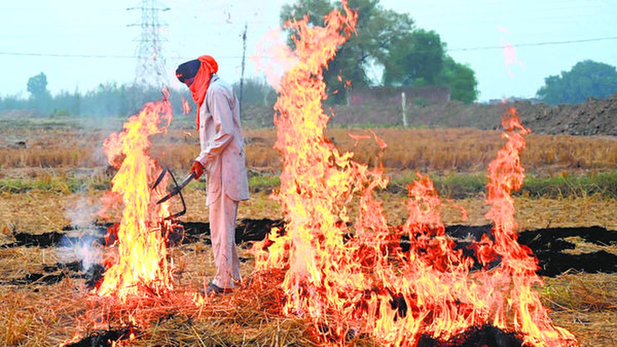
The story so far: The air quality in the national capital has been struggling to recover from the lows to which it dropped right after Deepavali despite the implementation of GRAP stage IV measures, the active intervention of the Supreme Court, and stop-gap measures by the Delhi government. Many fingers are currently pointed at the farm fires in the surrounding states, where farmers are burning paddy stubble in time for the wheat-sowing season. While these fires aren’t solely responsible for Delhi’s plight, a controversy over measuring their prevalence illustrates the amount of attention they’re receiving.
Farmers in Punjab and Haryana sow rice in the kharif season and harvest it in November, using the summer monsoons to quench the crop’s high water demand. After the rice is harvested, they need to clear the leftover organic material — called paddy stubble — in order to make way for the next sowing season. For reasons of time and cost, they have traditionally preferred to burn the stubble.
But thanks to the winds at this time of the year over the National Capital Region, the toxic particulate matter from the fires is floated to and hangs over New Delhi, dragging its air quality down.
Because of the large area over which farmers light the fires, officials have said satellites are the best way to track the fires. The Indian government currently procures this data from two NASA satellites called Aqua and Suomi-NPP.
NASA launched Aqua in 2002 and it is currently in the twilight stage of its designed lifespan. Its Moderate Resolution Imaging Spectroradiometer (MODIS) instrument was built to track changes in the lower atmosphere, especially over land, through time. MODIS’s technical successor is the Visible Infrared Imaging Radiometer Suite (VIIRS) instrument onboard Suomi-NPP, which NASA launched in 2011. Both satellites are part of NASA’s ‘Earth Observing System’.
Aqua’s and Suomi-NPP’s overpass at each location happens at 1.30 pm local time in the day and at 1.30 am local time at night. Their MODIS and VIIRS instruments collect high-resolution visible and infrared images of the earth at around these intervals and are capable of spotting fires and smoke in a small window centred on the overpass time.
On October 2, a senior scientist at NASA’s Goddard Space Flight Centre named Hiren Jethva wrote on X (Twitter) that there were 40% fewer farm fires than predicted in 2023 and expressed hope for the trend to continue this year. On October 24, Jethva wrote in the same thread that the number of fires in 2024 seemed to be the “lowest in [the] last decade”, and added that either “ground efforts to curb residue-burning appear to be working or burning activities [are] taking place after satellite overpass time, but it needs ground-truthing”.

After a long, tiring day all we want is to jump right on our cosy beds and rest comfortably on our soft, fluffy pillows, right? Pillows are not quite appreciated as much as electric cars or air-fryers, for instance. Pillows are a wonderful man-made creation that has improved the lives and sleep of people across the globe. Did you know ages ago people used to rest their heads on a HARD ROCK? So how did humans go from sleeping on stones to cosy, fluffy and soft pillows today? Let’s get into the origin of your everyday pillows!

As the November 30 deadline nears for installing vehicle location tracking devices (VLTD) and emergency panic buttons in public service and nationally permitted goods vehicles in Karnataka, transport unions representing cab, bus, and truck operators are urging the government to reconsider the mandate. They argue that the high cost of these devices and a lack of awareness have made it difficult for many vehicle owners to comply with the requirement.


