Siachen: 40 years of Op Meghdoot
The Hindu
An explainer on Operation Meghdoot on Siachen glacier which marked its 40th anniversary on April 13
“The land is so barren and the passes so high that only the best of friends and fiercest of enemies come by” — reads a Ladakhi saying at Kumar post on the Siachen Glacier located at an altitude of 15,632 feet. The saying captures the conflict on the icy glacier between India and Pakistan. April 13, 2024 marks four decades since the Indian Army pre-empted Pakistan and occupied the glacier on the Saltoro ridge, overlooking the Nubra valley in the Karakoram ranges. Extreme weather is the biggest enemy on the glacier. Around 1,150 soldiers have lost their lives, majority of them to the vagaries of extreme weather.
Siachen, in Balti language means “land of roses’ — ‘Sia’ is a kind of rose species that grows in the region and ‘Chen’ means “in abundance”. However, it is known for being the world’s highest and coldest battlefield. It sits at a very strategic location with Pakistan on the left and China on the right.
Siachen is a legacy of the Partition between India and Pakistan. While the Line of Control (LoC) was delineated and accepted by both sides upto NJ-9842 as part of the 1972 Simla agreement, the glacier itself was left unmarked. India claims the area based on the Jammu and Kashmir Accession Agreement of 1947 and the Karachi Agreement of 1949, which define the ceasefire line beyond NJ-9842 as running “Northwards to the glaciers”. On the other hand, Pakistan interprets it as ‘North-Eastwards’ to claim the area beyond the Saltoro Ridge and beyond Siachen as its own. This would give Pakistan direct connectivity to China as well as strategic oversight over the Ladakh region and the crucial Leh-Srinagar highway, posing a serious threat to India.
In the 1970s and 1980s, Pakistan began allowing foreign mountaineering expeditions, resorting to cartographic aggression, to add credence to its claims. Following intelligence inputs of imminent military action by Pakistan in early 1984, India moved to pre-empt it.
Mountaineering expeditions led by Col. Narinder ‘Bull’ Kumar to the Siachen glacier and Saltoro range as Commandant of the High Altitude Warfare School (HAWS) in the early 1980s helped immensely in the planning process leading up to Operation Meghdoot. Based on these recce reports, the Indian Army launched ‘Operation Meghdoot’ on April 13, 1984 to capture the 76.4 km-long glacier. This was accomplished after a platoon of 4 Kumaon led by then Captain Sanjay Kulkarni (retired as Lt Gen) planted the Indian flag at Bilafond La at an altitude of 18,000 feet. Personnel from the Ladakh Scouts were also deployed via Cheetah helicopters by the Indian Air Force (IAF).
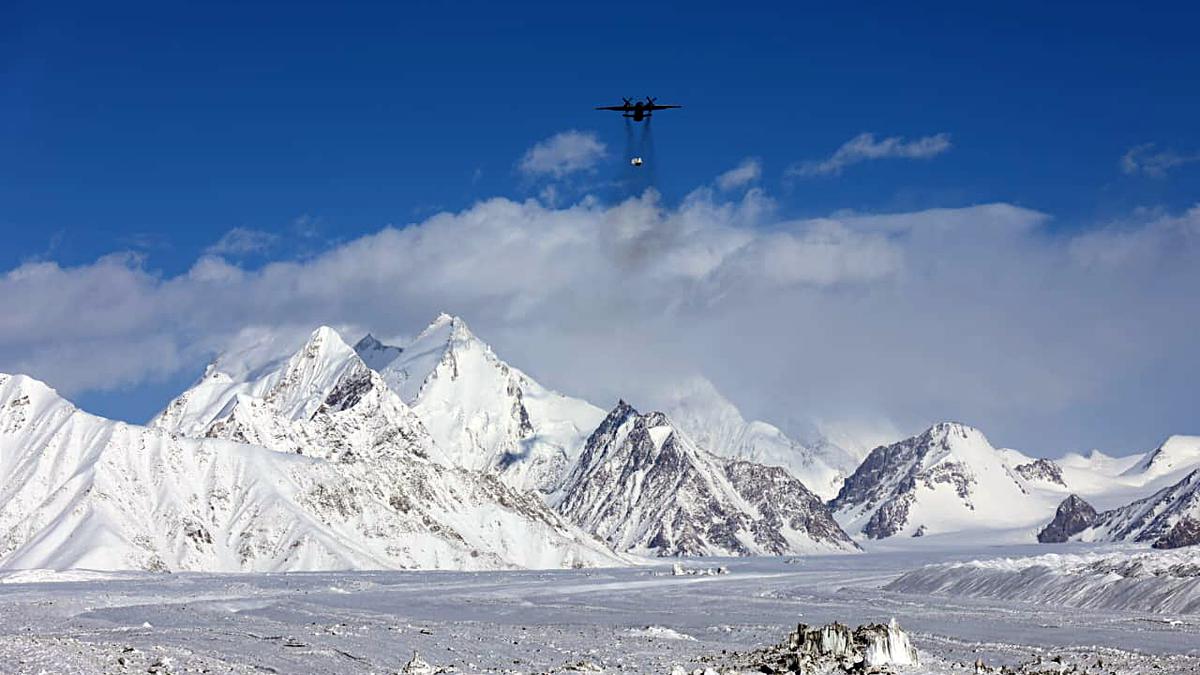
Although the operation began in 1984, IAF helicopters were already operating in the glacier with the first landing of a Cheetah helicopter in October 1978. Additionally, in preparation for the operation, IAF’s tactical and strategic airlifters, An-12s, An-32s and IL-76s transported stores and troops and air-dropped supplies to high altitude airfields, from where Mi-8, Mi-17, Cheetah and Chetak helicopters ferried men and material to the icy heights on the glacier, far above the limits helicopters were meant to be operated. Soon, about 300-odd troops were positioned on the strategically important peaks and passes of the glacier, the IAF recounted in a statement on Operation Meghdoot.
In June 1987, Indian troops captured the Quaid post at 21,153-feet under Operation Rajiv. The post was later renamed the Bana top, in honour of then Naib Subedar Bana Singh (later Subedar Major and Hony Captain) from 8-Jammu and Kashmir Light Infantry (JAK LI) who was also conferred the Param Vir Chakra, India’s highest wartime gallantry award for leading the attack in an impossible situation by scaling a 1,500 foot ice wall.

Ranya Rao, caught smuggling gold at Kempegowda International Airport, claimed innocence, but agencies suspect syndicate involvement.

World Sleep Day: More than 26% of professionals said they are getting less than six hours of sleep in the night, a problem even more pronounced among entrepreneurs.

Samuel Browne's botanical explorations in 17th-century Madras offer insights into traditional plant uses and changing flora over time.

CPS Abolition Movement protests in Dindigul urging State government to implement old pension scheme promised by DMK.

Union Finance Minister criticizes removal of Indian currency symbol '₹' in Tamil Nadu Budget 2025-26 documents, citing national unity concerns.

State government provides ₹100 crore to KMRL for Kakkanad extension, speeding up construction and addressing funding issues.

ED joins probe into gold smuggling case involving Kannada actor Ranya Rao, raids multiple locations in Bengaluru.

Bombay High Court questions Maharashtra government on failure to register FIR against police officers in custodial death case.

Uttar Pradesh Minister Sanjay Nishad faces backlash for suggesting those who have issues with Holi colours should leave the country.

Tamil Nadu sees improved Olive Ridley turtle nesting season with over 2.5 lakh eggs collected, efforts to protect marine life.

Speeding bus crash on Paramakudi-Madurai highway kills woman, injures 23; driver flees scene, causing critical injuries.

Transport Minister flags off private and KSRTC buses from Goshree islands to Kochi city, improving public transportation.

TSPSC clarifies Group-I Mains exam evaluation process, releases key statistics, and addresses misinformation, ensuring fairness and transparency.