A break in the Western Ghats Premium
The Hindu
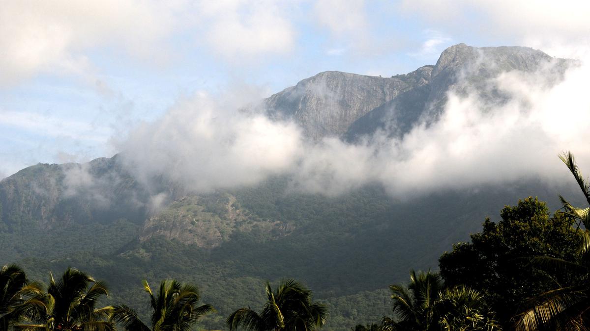
The Palghat Gap is a corridor for both roads and railways that connect Coimbatore with Palakkad.
Often called as a significant discontinuity in the Western Ghats, the Palghat Gap is about 40 km wide, with the steep Nilgiris and Anamalai hills, both rising above 2,000 msl, on either side.
The Palghat Gap has historically been important as a significant gateway into the State of Kerala. It is a corridor for both roads and railways that connects Coimbatore with Palakkad. The Bharathappuzha river flows through it. In contrast to the tropical rainforests of the Western Ghats, the vegetation in the Palghat Gap is classified as dry evergreen forest. It also marks a divide in the flora and fauna of the region. For example, several species of frogs are found only on one side of the Gap.
The Gap is a geological shear zone that runs from east to west. Shear zones are weak regions in the earth’s crust — this is the reason why tremors are sometimes felt in the region Coimbatore.
The origin of the Palghat Gap also stems from the drift of continental shelves after Australia and Africa broke off from the Gondwana landmass.
India and Madagascar remained as one landmass until large-scale volcanic activity split the two, the split occurring where the Palghat Gap is located — this is mirrored in the Ranotsara Gap on the eastern face of Madagascar. How long ago did the Gap originate? The landmass split about 100 million years ago, and the Gap had formed before this; although how long before is debated.
It has been speculated that one reason for the biogeographic distinctions in species in north and south of the Gap could be due to an ancient river or an incursion of the sea in the distant past.
Elephant populations on the Nilgiris side differ in their mitochondrial DNA from elephants in the Anamalai and the Periyar sanctuaries.

Ranya Rao, caught smuggling gold at Kempegowda International Airport, claimed innocence, but agencies suspect syndicate involvement.

World Sleep Day: More than 26% of professionals said they are getting less than six hours of sleep in the night, a problem even more pronounced among entrepreneurs.

Samuel Browne's botanical explorations in 17th-century Madras offer insights into traditional plant uses and changing flora over time.

CPS Abolition Movement protests in Dindigul urging State government to implement old pension scheme promised by DMK.

Union Finance Minister criticizes removal of Indian currency symbol '₹' in Tamil Nadu Budget 2025-26 documents, citing national unity concerns.

State government provides ₹100 crore to KMRL for Kakkanad extension, speeding up construction and addressing funding issues.

ED joins probe into gold smuggling case involving Kannada actor Ranya Rao, raids multiple locations in Bengaluru.

Bombay High Court questions Maharashtra government on failure to register FIR against police officers in custodial death case.

Uttar Pradesh Minister Sanjay Nishad faces backlash for suggesting those who have issues with Holi colours should leave the country.

Tamil Nadu sees improved Olive Ridley turtle nesting season with over 2.5 lakh eggs collected, efforts to protect marine life.

Speeding bus crash on Paramakudi-Madurai highway kills woman, injures 23; driver flees scene, causing critical injuries.

Transport Minister flags off private and KSRTC buses from Goshree islands to Kochi city, improving public transportation.

TSPSC clarifies Group-I Mains exam evaluation process, releases key statistics, and addresses misinformation, ensuring fairness and transparency.