Vernon completes floodplain maps, considers development regulation
Global News
A key part of the new rules would likely be regulation of "flood construction level," which is how high above sea level new buildings need to be built.
Nearly five years after the destructive 2017 floods, flood mapping aimed at making B.C.’s Okanagan more resilient is starting to have a tangible impact.
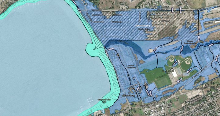
Building on floodplain mapping done by the Okanagan Basin Water Board around Okanagan Lake, the City of Vernon has recently completed its own floodplain maps of local creeks.
The municipality is looking at upgrading infrastructure and changing development rules to minimize loss when waters rise.
“What we found is that the risk of flooding is fairly high but it is increasing over time,” said Anna Warwick Sears, the executive director of the Okanagan Basin Water Board.
“What we looked at was the flood of 2017, which is the biggest flood in living memory. That flood was considered a 1 in 500-year event, but with climate change, it will happen more and more frequently. So we are asking communities to get ready now.”
The City of Vernon is trying to use the floodplain maps to prepare.
“We could see clearly where our culverts and our bridges were causing constriction and increasing the impact of potential for flooding,” said Mayor Victor Cumming.
“Feasibility work has been approved by council…to sort out where we can, with the least cost and the maximum benefit, provide some new infrastructure in those places to prevent them from contributing to flooding when we have high water levels.”


 Run 3 Space | Play Space Running Game
 Traffic Jam 3D | Online Racing Game
 Duck Hunt | Play Old Classic Game


