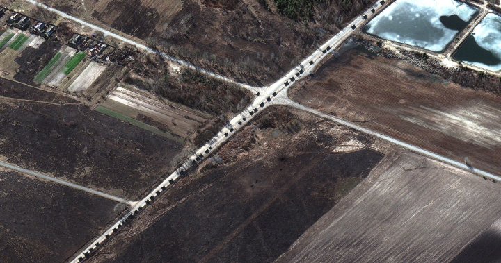
Satellite photos show Russian military convoy over 60km long headed toward Kyiv
Global News
The images suggest the military convoy threatening the Ukrainian capital is more than twice as long as originally reported, and is about five kilometres outside the city.
New satellite images are providing a clear look at the sheer size of the Russian military convoy advancing toward the Ukrainian capital of Kyiv.
The photos, which were taken Monday and provided to Global News by American space technology company Maxar, suggest the convoy is nearly 65 kilometres (40 miles) long, stretching from near Antonov airport in Hostomel in the south to the northern-end of the convoy near the village of Prybirsk.
Hostomel lies just five kilometres outside the Kyiv city border.
Images taken earlier in the day, also by Maxar, suggested the convoy was about half the size, stretching about 27 kilometres (17 miles) long.
The company said cloud cover limited the full view of the convoy’s length early Monday morning.
The new photos also show what Maxar said were burning homes and buildings north and northwest of Ivankiv, near the roads where the convoy is travelling.
Maxar noted the vehicles, which include large equipment transports and troop units, are sometimes spaced fairly far apart in some areas along the convoy route, while in others the vehicles are travelling two or three at a time.
The company said cloud cover limited the full view of the convoy’s length earlier Monday.


