Satellite images show scale of Chile deadly wildfires, destroyed neighborhoods
CBSN
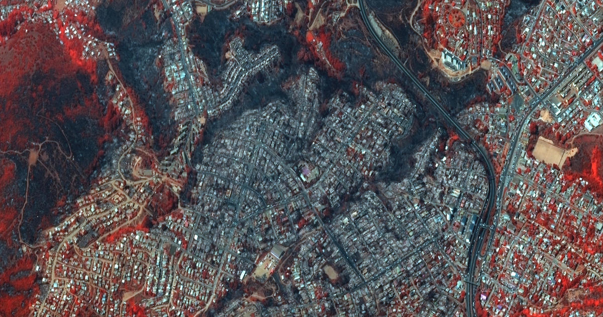
New satellite images show the extent of the widespread damage caused by raging wildfires in Chile's scenic Valparaíso region that have killed least 122 people.
On Monday, the space technology company Maxar gathered multiple satellite images of entire neighborhoods east of the resort town of Viña del Mar that have been destroyed. The images, collected at 11:48 a.m. local time, do not show active wildfires but burn scars left behind from the flames.
On Monday, Chile's state forensic agency reported the toll stood at 122 dead, with only 32 of the victims identified. President Gabriel Boric had warned Sunday that an earlier death toll of 112 could rise "significantly."
More Related News