


Palestine to Africa: How maps lie — and some tell the truth
Al Jazeera
Conflicts in Palestine, Ukraine, the Indian Ocean and other areas also spill over into the realm of cartography.
Google Earth came into existence in 2005. A year later, it experienced a revolutionary tremor.
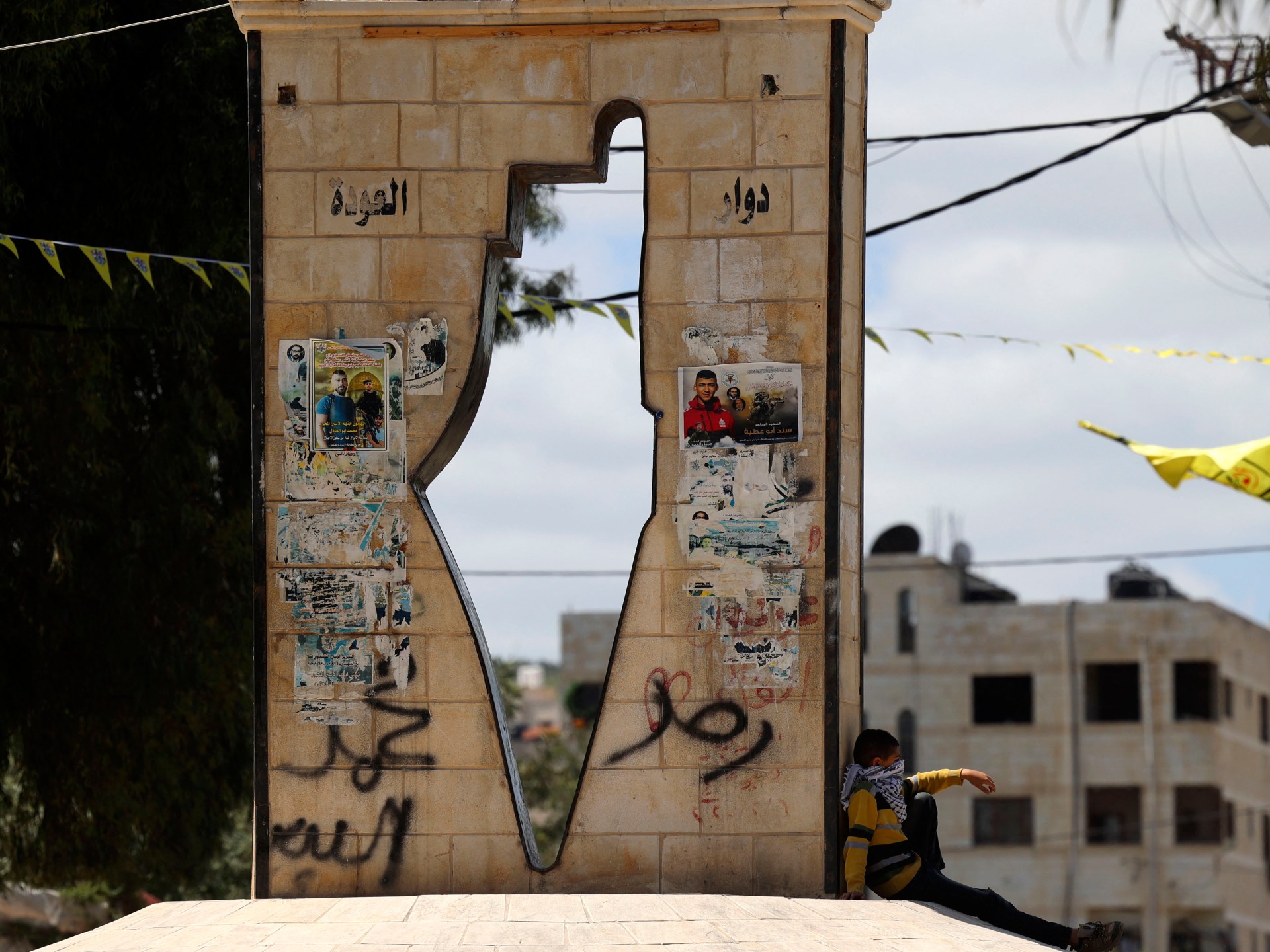
A Palestinian man from Jenin, Thameen Darby, created the Nakba Layer, mapping Palestinian villages that were destroyed or depopulated in the 1948 Arab-Israeli war. The maps showed parts of Palestine that are not even seen in maps created by Palestinian authorities, geographer Linda Quiquivix who researched the Nakba map and maps of Palestine, told Al Jazeera.
The Nakba map of 2006 sparked controversy and anger among some Israelis who reported it to their local police for being an “assault on true geography”.
But what is true geography? Do the maps we see every day accurately represent borders and spaces?
“Not only is it easy to lie with maps, it is essential,” wrote cartographer Mark Monmoneir in his book, How to Lie with Maps.
 Run 3 Space | Play Space Running Game
 Traffic Jam 3D | Online Racing Game
 Duck Hunt | Play Old Classic Game