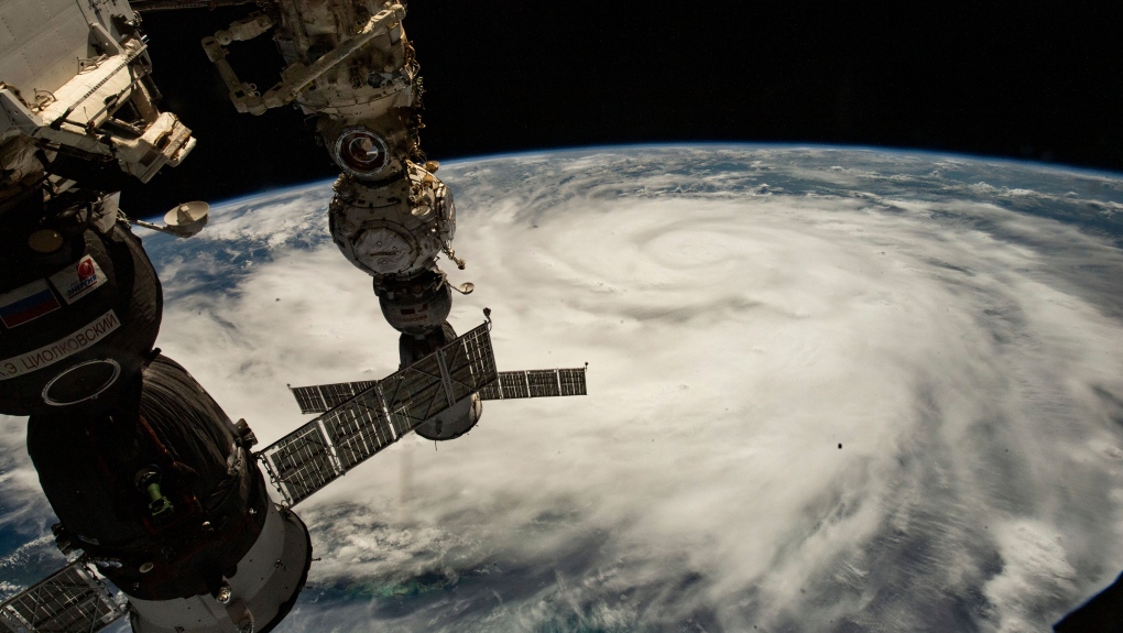
Hurricane Ian hitting Florida's coast with 250 km/h winds, just shy of Category 5 status
CTV
Hurricane Ian's most damaging winds began hitting Florida's southwest coast Wednesday, lashing the state with heavy rain and pushing a devastating storm surge after strengthening to the threshold of the most dangerous Category 5 status.
Hurricane Ian's most damaging winds began hitting Florida's southwest coast Wednesday, lashing the state with heavy rain and pushing a devastating storm surge after strengthening to the threshold of the most dangerous Category 5 status.
Fueled by warm waters in the Gulf of Mexico, Ian grew to a catastrophic Category 4 hurricane overnight with top winds of 155 mph (250 km/h), according to the National Hurricane Center. The storm trudged on a track that would have it making landfall north of the heavily populated Fort Myers area, which forecasters said could be inundated by a storm surge of up to 18 feet (5.5 meters).
"This is going to be a nasty nasty day, two days," Florida Gov. Ron DeSantis said, stressing that people in Ian's path along the coast should rush to the safest possible shelter and stay there.
Ian menaced Florida after bringing destruction Tuesday to western Cuba, where two people were reported dead and the storm brought down the country's electrical grid.
Ian's center was about 50 miles (80 kilometers) west of Naples at noon Wednesday, as it churned toward toward the coast at 9 mph (15 km/h). Ian's plodding pace meant the storm was expected to spend a day or more crawling across the Florida peninsula, dumping flooding rains of 12 to 18 inches (30 to 45 centimeters) across a broad area including Tampa, Orlando and Jacksonville in the state's northeast corner.
Catastrophic storm surges could push 12 feet (3.6 meters) of water or more across more than 250 miles (400 kilometers) of coastline, from Bonita Beach to Englewood, the hurricane center warned.
"It's going to get a lot worse very quickly. So please hunker down," DeSantis said.
