Has There Been A Major Undercount Of Punjab Farm Fires? What Satellite Pics Show
NDTV
Several factors contribute to Delhi's inferior quality, including construction, the city's vehicular pollution and the stubble burning by farmers in Punjab and Haryana.
Delhi and its adjoining areas are covered in smog and air quality is still in the 'very poor' category. The fourth stage of anti-pollution measures will remain in effect for three days as no sign of relief is expected soon.
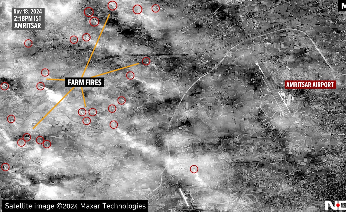
Several factors contribute to Delhi's inferior quality, including construction, the city's vehicular pollution and the stubble burning by farmers in Punjab and Haryana. While the Central Air Quality Management (CAQM), the pollution control body, has appreciated Punjab for significantly bringing down the cases of stubble burning in the state, scientist Hiren Jethva at NASA Goddard Space Flight Centre, differs and told NDTV that farmers are timing stubble burning with NASA satellites overpass time over the subcontinent leading to severe undercounting. Now, exclusive satellite images accessed by NDTV appear to confirm the inference.
NDTV accessed satellite images of a small area west of Amritsar, to understand the extent of farm fires on November 18 at 2:18 pm. It may look like an image of a warzone, but the smoke is not from the impact of bombs but from farmers burning their agriculture stubble. The red circles indicate the location of farm fires in a small area lying west of the Amritsar airport.
