Hands-on map helps Edmonton students learn about Indigenous communities across Canada
Global News
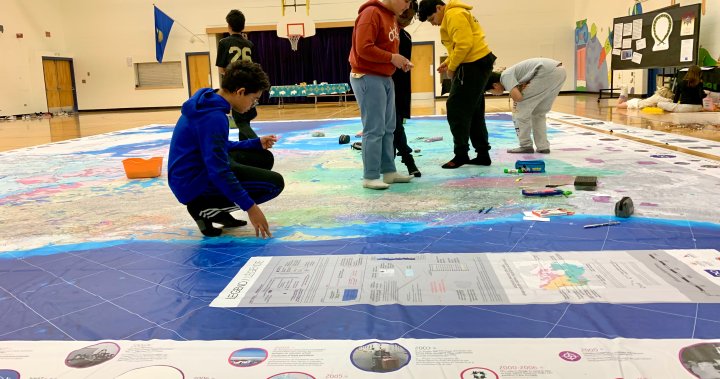
A giant 11-by-eight-foot map lies across the gym floor of Sweet Grass Elementary School in Edmonton with students crawling all over it.
A giant 11-by-eight-foot map lies across the gym floor of Sweet Grass Elementary School in Edmonton with students crawling all over it.
The Indigenous Peoples Atlas of Canada, created by the Royal Canadian Geographical Society, shows the locations of Indigenous communities, residential schools and reserves and also identifies different Indigenous languages. The map also highlights historical dates of importance and touches on important topics like colonization.
The RCGS said the map is meant to be an educational resources to help students “understand the past, present and future of Indigenous peoples in Canada.”
“It’s a giant walkable map,” said Vanessa LeCaine, principal at Sweet Grass School. “They can walk through, see all of the different communities, where all the different languages are. It’s a great way to learn about Indigenous communities.”
The map is being used by a handful of school divisions, including the Edmonton Public School Board, to teach students about Indigenous communities across Canada.
“There is lots of learning that accompanies the map,” LaCaine said. “We brought it in last year and it was so impactful to our students, we found a way to purchase the map for our school and now we have our own copy.”
LaCaine said teachers at Sweet Grass have found a way to incorporate the map into all of the grade levels.
“We’ve got the Grade 6 class in here now, but there’s even kindergarten children coming to learn,” LeCaine added. “On this map there are no borders, you see the land as it’s meant to be — one giant country.”
