Cyclone ‘Mandous’ brewing over the Bay likely to impact several parts of Tamil Nadu
The Hindu
It is likely to hit north Tamil Nadu and Puducherry coasts around Friday midnight, and bring intense rain in many districts of T.N. between Thursday and Saturday
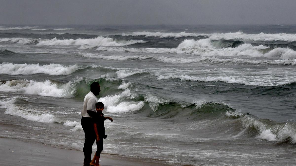
With the cyclonic storm ‘Mandous’, brewing over the Bay of Bengal, likely to hit north Tamil Nadu and Puducherry coasts around Saturday morning, intense rain may lash many districts of Tamil Nadu between Thursday and Saturday. The weather system may produce extremely heavy rain in a few districts on Friday.
‘Mandous’ is likely to cross between Puducherry and Sriharikota during early hours of Saturday. Weather models have predicted that it may cross the coast as a cyclonic storm. Places along the coast may experience squally winds with a speed of 65-75 kmph and going up to 85 kmph during landfall, said S. Balachandran, Additional Director General of Meteorology, Chennai.
Rain may lash from Thursday afternoon and pick up gradually. Heavy rain, above 21 cm, may peak on Friday in one or two places in Puducherry, Villupuram, Kancheepuram and Chengalpattu. It may continue till Saturday afternoon until the weather system moves inland, he said.
While four places have been issued red-colour coded warning for torrential rain, the north coastline from Tiruvallur to Nagapattinam have been warned of strong winds on Friday.
The weather system has increased hopes of bridging the rain deficit over the State this monsoon season.
The cyclone may break the rain hiatus in Chennai and bring heavy to very heavy rainfall over parts of the city on Friday and Saturday. The city’s maximum temperature remained close to normal of 29.1 degree Celsius on Wednesday. According to the India Meteorological Department, the deep depression may intensify into a cyclonic storm and reach southwest Bay of Bengal off north Tamil Nadu, Puducherry and south Andhra Pradesh coast by Thursday morning. It may continue to move towards the north Tamil Nadu and south Andhra Pradesh coasts.

Jadavpur University loses Institute of Eminence status due to budget cut, sparking political controversy and student protests.

Hyderabad's Government Super Speciality Veterinary Hospital offers affordable pet care, bridging the gap in pet healthcare services.

Majestic, once a bustling shopping hub, now struggles with declining footfall due to online shopping trends.

Kasthurba Gandhi Kanya Gurukulam: A legacy of women's empowerment, Gandhian values, and inclusive education for underprivileged students.

Andhra Pradesh SIPB approves ₹3.10 lakh crore investments, targeting 3.12 lakh jobs, including major projects by ArcelorMittal and BPCL.

Tamil Nadu Budget 2025: Follow The Hindu's live updates for Tamil Nadu’s Budget on March 14, 2025.

Technicolor India's sudden closure shocks 3,200 employees in Bengaluru and Mumbai, impacting the global AVGC-XR industry.

Telangana MLA suspended for insulting Speaker, sparking debate on democracy and opposition stifling in Assembly.

Technicolor India's sudden closure shocks 3,200 employees in Bengaluru and Mumbai, impacting the global AVGC-XR industry.

Air Chief Marshal A.P. Singh emphasizes innovative security measures and global readiness at Southern Air Command conference.

World Kidney Day highlights the rising prevalence of kidney issues among young Indians, emphasizing the importance of early detection and prevention.

Yogendra Yadav and T.M. Krishna discuss NEP’s strong pitch for a three-language formula and the fear, especially in Tamil Nadu, that there is an attempt being made to impose Hindi on non-Hindi speaking States

Kolkata People's Film Festival showcases political documentaries and short fiction from South Asia, emphasizing curatorial freedom and audience interaction.