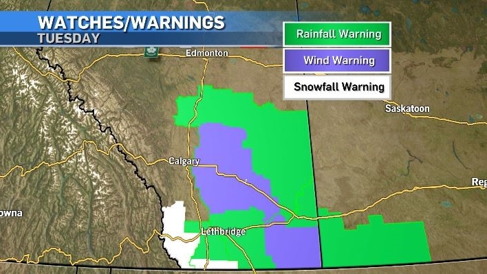
Cold, wet and windy – heavy, wet snow and up to 100 mm of rain possible in southern Alberta
CTV
An intense low pressure system of just 986 mb situated south of Saskatchewan will be the main weather maker in central and southern Alberta Tuesday.
An intense low pressure system of just 986 mb situated south of Saskatchewan will be the main weather maker in central and southern Alberta Tuesday.
Moisture is being pulled up from the U.S. Plains and Gulf and moving into central and southern Alberta as it circles counter-clockwise around this low which is acting as the southwestern anchor of an Omega block.
Cold Arctic air from the high is mixing with that precipitation and limiting daytime highs to well below seasonal for much of southern Alberta.
Throughout the day Tuesday and overnight Wednesday a cooler atmospheric profile will lead to heavy wet snow in portions of southern Alberta – especially along the southern foothills. It is possible some snow might start to accumulate during the day along the Highway 2 corridor south of Calgary and west of Calgary along the Trans-Canada highway, however warmer conditions Wednesday will make this is short-lived concern.
Rainfall totals for this multi-day event could exceed 50 milimetres east of Highway 2 and the QEII Highway with Environment and Climate Change Canada (ECCC) warning some areas may see more than 100 milimetres – or the equivalent of one month’s worth of rain in under 36 hours.


 Run 3 Space | Play Space Running Game
 Traffic Jam 3D | Online Racing Game
 Duck Hunt | Play Old Classic Game