Action plan for landslide management remains on paper two years after submission to government of Karnataka
The Hindu
The Karnataka State Action Plan for Management of Landslides was first prepared and submitted in 2022 by the Karnataka State Disaster Management Authority (KSDMA), which functions under the Revenue Department.
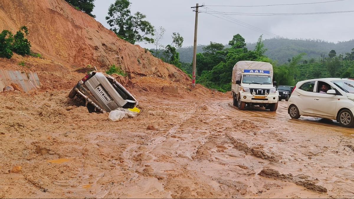
Even as several heavy earthmoving vehicles are pressed into service continuously for clearing rubble on National Highway 66, near Shirur in Uttar Kannada district, following landslides, the need for a Landslide Management Plan for vulnerable districts is being felt. This monsoon, landslides have claimed the lives of 10 persons so far.
The Karnataka State Action Plan for Management of Landslides was first prepared and submitted in 2022 by the Karnataka State Disaster Management Authority (KSDMA), which functions under the Revenue Department.
In the 85-page document, KSDMA had elaborated on the landslide vulnerability in Karnataka, monitoring, forecast, warning and dissemination mechanism, the need for landslide action plan, prevention, mitigation and preparedness measures, and other issues. It laid down the roles and responsibility framework to be set up at different levels, and the funding mechanism at various levels, including State and national level.
The document was prepared with data provided by GSI (Geological Survey of India) and KSNMDC (Karnataka State Natural Disaster Management Committee). According to the document, landslides affect at least 15.30% of the land area in Karnataka, exceeding 29,350.3 square kilometres spread over 29 taluks.
In one study period (2009-2021), the maximum number of landslides occurred in Uttar Kannada district (439), followed by Shivamogga (356), Chikkamagaluru (193), Udupi (99), Dakshina Kannada (88), Kodagu (79), and Hassan(18), according to the KSDMA. These landslides had led to loss of lives along with significant economic losses and social disruption.
While the 2022 data showed eight out of the 12 taluks in Uttar Kannada district had reported landslides in the past decade, in the last two years, their number had risen to 11 taluks. Consequently, the landslide susceptibility zone has expanded in the district. Experts say that a site that has reported a landslide once is always vulnerable to landslides.
As per the data, 11 out of the 12 taluks in the district fall under the Landslide Susceptible Zone, and are prone to low, moderate and high class of landslides.

Vijayawada Municipal Corporation prepares for Dasara festivities with sanitation workers, drinking water, toilets, health camp for workers.

Forum for Good Governance urges Telangana government to eliminate 'bogus' ration cards before issuing new smart cards to eligible families.

The Tiruchi City Corporation plans to start the trial run of a portion of the phase-II underground drainage (UGD) scheme in October

Federation of Karnataka Farmers’ Associations president urges State government for paddy bonus and sugarcane incentives, highlighting farmers' issues.

Health Department in Coimbatore intensifies surveillance for Mpox virus, screening international passengers at airport and inter-State checkposts.

Union Bank of India MD and CEO A. Manimekhalai on Wednesday said the bank plans to open four women-centric branches in the country to handhold women entrepreneurs by taking care of their needs.

Chennai Metro Rail to approve flyover construction at Saravanampatti junction for State Highways Department, enhancing traffic flow.

Minister urges parents in need to hand over babies to Social Welfare for care and adoption.

Congress party activists condemn BJP leaders for hate speech against Rahul Gandhi, demand action from authorities.

Housing Minister sets one-month deadline for updating Wakf property records in Kalaburagi and Yadgir districts, addressing encroachment issues.

Empowering rural women through science & technology initiatives for rural development showcased at CSIR-CFTRI event in Mysuru.